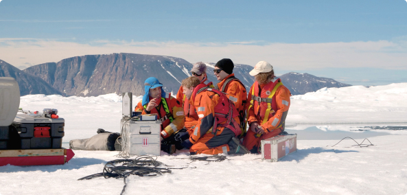
With most of the scientists at the coast, things have been calm at the Princess Elisabeth Station. In Belgium, preparations are being made for the departure of the cargo ship bringing supplies and equipment to Antarctica.
Holding the fort
The station has been quiet a lot quieter over the last few days. The IceCon scientists and InBev-Baillet Latour laureate Jan Lenaerts have been making progress on the King Baudoin Ice Shelf now that the weather has improved. Jan managed to take five firn cores for his BENEMELT project, while the IceCon team took some radar soundings of the neaby area and worked on drilling the second 150-metre ice core for their project. Veteran journalist Jos Van Hemelrijck and Polar Quest winner Roger Radoux have also gone to the ice shelf to accompany Denis Lombadri from the Royal Observatory of Belgium and expedition leader Alain Hubert as Denis installs more seismometers for the SMEAIS project.
The only scientists left at the station are Alexander Mangold and Quentin Laffineur from the Royal Meteorological Institute of Belgium. They spend their time keeping track of the data their 12 instruments collect, and launch a meteorological balloon to collect atmospheric data every day at noon. They share the data they collect with the German Neumayer Station at the coast, which puts together weather forecasts for the Queen Maud Land region of East Antarctica.
Keeping Alexander and Quentin company at the station are engineers, electricians and mechanics who take care of the day-to-day functioning of the station. There's always something to keep them busy!
“We're only 12 people now, so it's been much quieter this week,” Alexander explained. “It will be a lot busier once everyone is back form the coast. We'll have 35 people at the station again.”
Cargo ship to leave Zeebrugge
Meanwhile in Belgium, preparations are being made for the departure of the cargo ship that will transport supplies and equipment from the North Sea port of Zeebrugge to the BELARE team in Antarctica. Unfortunately, the cargo ship doing the job this season has been delayed by bad weather in the North Atlantic on its journey from Greenland to Belgium. Instead of arriving the morning of Friday, December 12th as scheduled, the cargo ship is expected to arrive sometime on Saturday, December 13th.
Once the ship arives, the loading of the cargo will begin in earnest. Food and equipment are part of the cargo, along with two new specially adapted Toyota Hi-Lux vehicles. The heavy-duty Hi-Luxes have been modified to haul heavy loads across snow and ice in Antarctica: Instead of tyres, they have caterpillar tracks!
The ship is scheduled to arrive at the coast of East Antarctica in late January, after a short stopover in Cape Town. Hopefully the sea ice around the coast of East Antarctica will be easier to handle than last season!
This Sunday, I learned that Antarctica was in fact a very dry continent and how aerosols and particles were playing a role in that dryness. Ironically, that was in stark contrast with the recent news from the coast, where our friends were getting massive amounts of snowfall dumped on them.
Remembering Queen Fabiola
Last Friday, we learned that Queen Fabiola had passed away. In sign of mourning, the Belgian flag at the station has been flying at half mast. It will stay that way for a few more days. After all, Princess Elisabeth is a little piece of Belgium in Antarctica, and we all wanted to pay our respects.
Bad weather at the coast delays progress
We had news from the team at the coast yesterday, and unfortunately the weather has been quite a hassle. It has been snowing very heavily. An entire day was lost for both for researchers and crew. Near white-out conditions make scientific work in the field impossible, and repairs on one of our venerable Prinoth tractors had to be postponed. This morning, one scientist even woke up to discover that the entire inside of his tent filled with snow overnight because of the wind.
Time is running short for the ICECON and BENEMELT scientists. They must soon leave their camp on the Derwael Ice Rise and move out close to the edge of the King Baudouin Ice Shelf, where they hope to drill a few 150 metre-deep ice cores, weather permitting. Let's hope the weather will be better soon so they can accomplish what they came for!
Particles, aerosols and snowfall
Meanwhile at the Princess Elisabeth station, our meteorologists, Alexander Mangold and Quentin Laffineur from the Royal Meteorological Institute of Belgium, spotted something unusual while monitoring aerosols in the upper atmosphere: their instruments recorded a very sudden and sharp increase in the number of particles in the atmosphere above Utsteinen. At 6,000 particles per cubic centimetre, their concentrations were 20 times the usual amount of particles in the atmosphere.
Alexander told me that this increase had nothing to do with pollution. He believes that it might have been triggered by turbulence in the upper layers of the atmosphere, where these particles are formed.
Particles and aerosols play a big role in Antarctica's climate, so it's nothing to worry about. They play a huge role in the formation of clouds. If there were no particles or aerosols in the atmosphere that moisture could adhere to, no droplets could form and there would be no clouds, precipitation or snow.
In the austral summer, average concentrations of atmospheric particles average around 300 particles per cubic centimetre. In the winter, concentrations drop to 10 or 12 particles per cubic centimetre (even the best "clean room" laboratories with fancy air pumps and filters would struggle to get to such low levels of particles).
That's why, contrary to popular belief, Antarctica is a very dry continent, with very little snowfall ... except at the coast these days it seems ...
The weather has improved for the scientists at the coast, Denis Lombardi finally has some good news, and Jos Van Hemelrijck learns why covering up properly in Antarctica is important for your health.
Good news from the coast
First and foremost, we’re happy to report good news from the coast. Wednesday it stopped snowing, and scientists from the IceCon project at the ULB have made good progress extracting ice cores on Derwael Ice Rise.
Yesterday they finished drilling the first 30-metre ice core, and today (Friday), they’re working on drilling a second one. Meanwhile, Nicolas Bergeot set up his GPS observatory on the ice and Frank Pattyn and Brice Van Liefferinge are scanning the ice layers of Derwael Ice Rise with their radar machines.
Now or never!
Keeping an eye on the weather forecast, we knew that Thursday would be the best day of the week at the Princess Elisabeth station. Seismologist Denis Lombardi had two more seismic observatories to service up on the high plateau, a fair distance away from the station. It’s impossible to go up there in bad weather. One observatory is on the southern flank of the Sør Rondane Mountains, while the other is way out on the ice, 70 km from the station. So on Thursday morning, BELARE team leader Alain Hubert decided it was our only chance to make a dash for the plateau before bad weather returned, so we went for it.
After breakfast, Alain, Denis and I rode off on skidoos. We first went out to Teltet Nunatak, a hill 6 km east of the station. From there, we turned right and made for Gunnestad Breen (a breen is a glacier in Norwegian). Alain had taken flag-topped bamboo sticks to mark out a safe path for us along the way.
Natural wonder
It took us over an hour riding over rough sastrugi (wind-carved hills in the snow surface) before we arrived at the glacier. It was an amazing spectacle to see this mighty river of ice flowing down from the centre of the ice sheet trough a 10 km wide gap in the Sør Rondane Mountains.
The glacier, on its slow descent from the interior of the ice sheet to the sea, bends and cracks. Its surface is riddled with mostly invisible crevasses. Alain had staked out a safe way up the glacier with bamboo markers during previous trips. He carefully checked the position of each with a GPS and compared them to last year’s position. Of course they had moved. The glacier moves at a speed of 30 to 40 metres a year. It’s incredible when you think about it: ice flowing, and at such a speed!
Antarctica’s vast, unforgiving desert
We slowly made our way up the glacier towards the edge of the Antarctic High Plateau. We were more than 2 km above sea level! Between here and the South Pole, 3,000 km away, there is nothing but empty, white desert.
A vicious wind blew from the interior of the continent. “It’s the katabatic wind,” Alain explained. Cold air flows down from the interior of the ice sheet and accelerates under its own weight as it heads out to the coast of the continent.
The ride to Denis’ seismic observatory seemed to take forever. Drifting snow made it impossible to see very far ahead. We had to follow carefully behind Alain.
The data-logger is alive!
And then suddenly we had arrived. Out of the white gloom we saw a dark angular shape sticking out of the snow: the solar panel that provides energy to Denis’ instruments. The seismometer itself is buried in the ice, but the data logger and battery sit in a black insulated box above the surface.
Alain and Denis immediately got to work unscrewing the top of the box. As you know, all of Denis Lombardi’s data loggers had given up functioning sometime during the austral winter. So we thought Denis would just take out the data logger, close the lid, and we’d be off from this windy place. But lo and behold - the data logger was still working! This was totally unexpected.
Denis had to collect the data, replace the flash card, install a new battery, and reboot the system. We hadn’t even brought a shelter or tent to work in, so it wasn't easy. When we removed the lid from the data logger, drifting snow filled up the interior and covered everything with fine ice particles.
It was so cold that Denis’ rugged Toughbook computer refused to start up. His fingers hurt when he dared to take of a glove for a few seconds. We tried to shield him from the wind and the cold, but it was hard. At times I just wanted to give up and crawl under a skidoo to take cover from the relentless wind. But after an hour, Denis got the job done and we started our skidoos to make our way back.
Dress warmly, it’s cold up there!
Before leaving for the plateau, I had donned all the warm clothes I found, and put on over everything an insulated fur-hooded coverall. But by the time we started to make our way back, the balaclava I was wearing to cover my mouth had frozen stiff. My goggles were clouding over and my moustache was sporting a huge icicle, which I thought was quite funny.
The wind was now blowing hard from the right, and it was bitterly cold. Painfully cold. But there was not much I could do to protect myself from it while trying to follow in Alain’s tracks. Looking back, I should have stopped for a minute to cover my face better, but I decided not not to. Later in the day, I would come to regret that decision bitterly.
After a while the pain went away, and I was glad to see the Sør Rondanes reappearing in the distance. The second and last data logger to check for the day lay just ahead.
Dennis Lombardi found his seventh and last data logger had stopped like all but one of the others. His data are not complete. But there is hope that his seismic project in Antarctica will be saved. The manufacturer of the data logging computers has promised to try to do an emergency repair. Dennis will bring the six defective ones back with him when he leaves for Belgium on the 20th of December. The repaired data loggers will then be flown back to Antarctica on the first flight to the Princess Elisabeth station in February. Alain has promised Denis that he’ll re-install all six of the repaired data loggers again before the end of the season.
It will get worse before it gets better
When we parked our skidoos at the station’s garage, Denis asked me what I’d done to my face. “The right side is all red and swollen!” he remarked.
Concerned, I paid a visit to the station’s doctor, Jacques Richon. It turned out I had a frozen cheek. Frostbite. And very unsightly frostbite at that. Doc Richon told me that the skin would go black before it peels off, and that my cheek would swell even more the day after. He was right. This morning when I woke up, it was so swollen that I could hardly see out of my right eye.
But the Doc says the frostbite is not too serious. In a week or so, I should be fine. I have to be. I want to go to the coast!
Bad weather has moved into the Queen Maud Land, and the BELARE team must grin and bear it while continuing with the work plan of the season.
Weathering the storm
An easterly wind is still blowing at a brisk 20 knots (37 km/h) atop Utsteinen Ridge. The sky is overcast. Tomorrow the weather will be a little better according to our meteorologists, but conditions will get worse again the day after tomorrow.
For those of us based at the Princess Elisabeth station, the bad weather doesn't pose much of a problem. We can still work outside, and we don’t have to go far to find shelter. However things are a lot harder for our scientist friends at the coast. Out there, snow is falling abundantly. The storm has done a bit of damage and delayed progress of the BENEMELT and IceCon projects' field research. But the scientists had planned for potential setbacks, and are soldiering on in spite of the weather.
Those problematic data loggers...
Seismologist Denis Lombardi has been having a very difficult time of it. He’s desperately trying to determine exactly why the data logging equipment for the seismometers he installed on the plateau last year failed. He brought back four of the non-functioning data loggers to the station from the field to give them a thorough examination. Denis found that all four units went dead at some point or another during the Antarctic winter, leaving him with only part of the data he was hoping to collect.
Denis and electronics teacher (and Polar Quest laureate) Roger Radoux used a multi-meter to check the circuitry of the data loggers to look for tripped breakers or other possible faults. However neither were able to find a fault in the circuitry. Denis can now only hope that the manufacturers of the highly specialised machines will be able to give him an answer. If not, he may be faced with a situation where he has to collect all seven of the seismometers he installed on he plateau last year, bring them back to Belgium, and then return to Antarctica next season and replace them.
However first things first. The bad weather may hamper our efforts to return to the plateau. We still haven’t decided whether we’ll make the trip to the seismic site on the high plateau tomorrow, later or not at all.
Starting work on the geomagnetic observatory
Meanwhile, your veteran reporter, growing tired of being cooped up in the warmth of the station, went down to the foot of Utsteinen Nunatak to gave a hand to Alain Hubert and Jaques Touchette, who are busy building a shelter for the new geomagnetic observatory. The weather cannot hold these fellows back!
The shelter, which is being constructed for the GEOMAG research project, must be built exclusively of non-magnetic materials, and far away from the station. This will ensure that the readings from the instruments (which will eventually be installed in the shelter) will not be corrupted by electromagnetic signals form outside sources. This means that Alain and Jacques can only use wood, aluminium or high-grade stainless steel to construct the shelter. They must carefully check each item to be used in the construction with a magnetometer before they bring it to the construction site.
Antarctica doesn’t have very many geomagnetic observation stations, and the one being set up for the GEOMAG project will be one of the most sensitive in the world! One of the primary instruments that this shelter will house has been developed by Professor Jean Rasson of the Royal Meteorological Institute of Belgium’s Geophysical Center of Dourbes.
This weekend, Alain Hubert, Jacques Richon and Jos Van Hemelrijck accompanied Denis Lombardi on several trips to the mountains to check up on and service his seismometers. Later this week, they will take another trip to the plateau before heading to the coast to meet up with the IceCon and BENEMELT scientists. We also celebrated Antarctica Day!
A change in weather
The weather changed this past Sunday. The temperature went up to about -12°C or so. But a harsh wind from the east began to howl, blowing loose snow over the rocks of Utsteinen Ridge and making life difficult for those working outside.
The wind is still blowing hard today. We still have a trip to the plateau scheduled before departing for the coast on Thursday or Friday. Let's hope the wind has calmed down by then!
News from the coast
Things are going well for the IceCon and BENEMELT scientists who left for the coast on Friday. It took them 27 hours to get there, a bit longer than expected. The snow is deep and soft at the coast, and the heavily loaded Prinoth tractors had some difficulties getting up the Derwael Ice Rise. They set up the base camp, and their scientific work is progressing nicely.
Nicolas Bergeot dug out the autonomous GPS station he installed last year for the IceCon project. He had to raise it one metre higher to account for snow accumulation. Meanwhile, Kristof Soete dug a five metre wide trench with the snow tractor to clear access to a 120 metre-deep bore hole drilled last year. Jean Louis Tison and Morgane Philippe will inspect the hole with a probe camera to study the ice layers in the walls of the borehole. Meanwhile, Frank Pattyn and Brice Van Liefferinge are busy taking images of the ice below the Derwael Ice Rise with ice radar to find two ideal sites for this season's planned ice core drillings, which hope to extract 30 metre-cores.
While the weather held, field guides Raphy Richard and Christophe Berclaz did a reconnaissance trip to choose the site for the second base camp that will be set up on King Boudouin Ice Shelf.
A trip to the mountains
Meanwhile your veteran reporter had the time of his life (who can say that at 67?) going on two field trips to the mountains with seismologist Denis Lombardi. Alain Hubert and doctor Jacques Richon came along as our field guides. The first site we visited was on Vesthaugen Nunatak, some 30 kilometres north of the Princess Elisabeth station; the second day we went to Borchgrevink Fjellet, a mountain range 35 kilometres to te west.
The skidoo rides were quite an experience I must say. The snow in this part of Antartctica is not as soft and fluffy as you might think. The surface is often scarred. The harsh winds create a lot of sastrugi (dips in the snow surface), which make it a really rough terrain to ride a skidoo over. You get thrown around a lot even going as slow as 20 km/h. When the snow surface is smoother, you can open up the throttle (it's a lever that is activated by your right thumb) and go as fast as 40 km/h or more. Some powerful skidoos like Alain's can go up to 100 km an hour. I haven't managed to reach that speed myself!
Super sensitive seismometers
Denis Lombardi is a Frenchman working for the Royal Observatory of Belgium. Last season, he installed a series of seven very sensitive seismometers at different locations around the Princess Elisabeth station and in the Sør Rondane Mountains. Each seismometer is fitted with its own data logger, battery pack and solar panel.
"I could not use wind generators," Denis told me, "because the vibrations would disturb the measurements. These seismometers are so sensitive they can measure movements of 1 billionth of a metre."
Most of the seismometers are fixed on a rocky base and on into the ice itself. They help scientists understand the dynamics of the glaciers and the ice sheet as they flow towards the coast. Every quake or mini-quake in the ice is recorded, including the opening of a crevasse, or the calving of an 50 km-wide iceberg like the one that made headlines last year. The vibrations of that iceberg as it scraped the floor of the ocean were picked up by Denis' instruments, 200 km from the coast.
Disappointment for Denis
As soon as we reached the instrument set up on Vesthaugen Nunatak, Denis eagerly unscrewed the lid of the black insulated box next to the seismometer to check the data-logger. The instrument was not working. Apparently it had stopped recording sometime during the month of August. Denis was silent for a while as he digested his disappointment.
"It happened on two other sites," he admitted. "I still had some hope that it was a freak coïncidence. We had these instruments tested in a deep freezer," he explained. "I'm sure it's not the cold that causes this. But what could it be?"
The next day, at the site in Borchgrevink, we discovered that the logger for the seismometer Denis installed there last year had stopped working in April.
Denis took some time to investigate exactly what went wrong before setting up new seismometers for this season. It looks like three years of hard work have been jeopardised faulty electronics.
Not all is lost, however. A lot of useful data have been collected. But Denis would have liked to have collected seismic data over a complete cycle of 365 days.
Celebrating Antarctica Day
December 1st is Antarctica Day, the anniversary of the signing of the Antarctic Treaty in 1959. The treaty, which currently has 50 countries as signatories (including Belgium, which was one of the first countries to sign), forbids military action in Antarctica and preserves the continent for scientific research.
Every year the Princess Elisabeth station celebrates Antarctica Day. This year, we received a lot of drawings from children around the world, which Polar Quest laureate Roger Radoux and engineer Johnny Gaelens spent an afternoon hanging up. We took some photos of their efforts. It wasn't easy with the windy weather, but they managed to do a good job!
I also joined Roger Radoux and InBev-Baillet Latour Laureate Jan Lenearts as we Skyped with high school students in Belgium. They were excited to receive a call from Antarctica. It was a wonderful experience speaking to young and curious minds! Maybe one day some of them will visit the Princess Elisabeth station...
Scientists from the Universtié Libre de Bruxelles (ULB) and 2014 InBev-Baillet Latour Fellowship laureate Jan Lenaerts left for the coast on Thursday evening, eager to get to work on their research projects.
On the road again
The five ULB scientists form the IceCon project and Jan Lenaerts from the BENEMELT project have left the Princess Elisabeth station to start the 20-hour journey to the King Baudoin Ice Shelf at the coast, where they will conduct research over the next two to three weeks. Accompanying them will be field guides and mechanics to assist them and ensure their safety while they are on the ice shelf.
On Thursday Novebemr 27th at 9:15 pm, a convoy of two Prinoth tractors hauling a field container each behind them drove away from the Princess Elisabeth station. They carried with them all the equipment the scientists had been testing over the past week. Soon the scientists will put all their fancy new equipment to work!
With an average speed of 10-20 km/h, the journey to the ice shelf is expected to take about 20 hours. The convoy had to drive through the “night”. But as the sun is above the horizon 24 hours this time of year, it shouldn’t be too much of a problem staying awake for the long drive. One person will drive each Prinoth for a few hours while the others rest, before it’s someone else’s turn to drive. This will allow them to make good time, even if they have to take a slow vehicle.
The team is expected to arrive on Friday evening and set up their first camp on the Derwael Ice Rise, where the scientists will take radar soundings and ice cores for the IceCon project over the next several days.
Better safe than sorry!
The departure had originally been planned for Tuesday or Wednesday. However certain mechanical problems with the skidoos had to be fixed before the research team could leave.
It’s very important to have all equipment in top working condition before heading out into the field, considering the implications of running into mechanical problems in the middle of nowhere. It’s much easier to fix a skidoo at the station, where there is a garage with plenty of parts and tools, rather than out on an ice shelf.
The scientists had planned several extra days in their schedules to deal with unforeseen events, so there is still more than enough time to accomplish what they came to do in Antarctica before they leave.
We'll have an update from them in the coming days!
The ozone hole over East Antarctica has been quite large during the austral spring, and Belgian journalist Jos Van Hemelrijck has felt its effects firsthand.
A treacherous beauty
Antarctica is beautiful, but treacherous. I've managed to hurt my eyes. Tears were streaming out continuously this morning, and the reason is obvious: taking off my sun goggles too often while taking pictures in this beautiful yet intense sunshine.
Although temperatures where down to more than -20°C yesterday and the day before, sunlight here can still easily burn the skin of our unprotected faces and hands. Dr. Alexander Mangold, the scientist from the Belgian Royal Meteorological Institute who’s measuring the composition of the atmosphere over Antarctica for the BELATMOS project, warned us that levels of harmful ultraviolet (UV) radiation are extremely high where we are. In fact, right above our heads sits what’s left of the infamous hole in the ozone layer.
Still a cause for concern
The ozone layer has the unique ability to screen out a large amount of UV radiation that comes from the Sun, protecting living creatures on the surface of Earth from their harmful effects, which includes damaging DNA in living organisms (a process that can provoke certain kinds of cancer like melanoma).
If the ozone layer over Antarctica was healthy, it would provide protection for my eyes and skin. But unfortunately it’s not. Although the 1987 Montreal Protocol banned the use of ozone-depleting aerosols like chlorofluorocarbons (CFCs), scientists estimate that it will still take several decades before CFCs are completely flushed out of Earth’s stratosphere. Recent studies indicate that the ozone hole over Antarctica is finally on the road to recovery. However the healing process has been very slow. So the hole in the ozone layer over Antarctica will continue to exist until CFC concentrations fall below a critical limit.
A bad time of year for ozone
During the Antarctic winter, temperatures 20 km above the surface of the Earth in the stratosphere, where the ozone layer lies, fall below -80°C. At this height and under these freezing temperatures, polar stratospheric clouds form. The ice crystals of these clouds act as catalyst for ozone destruction. When the first sunlight returns in Antarctica towards the end of the Antarctic winter, the harmful chlorine molecules from the remaining CFCs in the atmosphere are released, and this starts the cycle of ozone destruction.
By the end of September, the ozone hole over Antarctica reaches its maximum extent. When the stratosphere starts to warm up again in spring, ozone depletion tapers off and levels of ozone slowly rise again.
Protect yourself!
However as it’s only the end of November, ozone levels have not had much time to recover since winter. Alexander showed us yesterday's satellite image indicating how low ozone levels currently are above East Antarctica. The recently installed Brewer ozone spectrophotometer on the roof of Princess Elisabeth station measured very low quantities of atmospheric ozone.
"They are down to 180 Dobson Units,” Alexander said with a concerned frown. “I have seldom seen them that low.”
Ozone concentrations are measured in Dobson Units (DU). Over most parts of the planet, ozone concentrations are about 300 DU. With ozone concentrations at 180 DU over East Antarctica, the UV index reaches values as high as 8, meaning that unprotected skin burns within minutes.
“Better use lots of sunscreen!” he warned.
As the winner of the 2014 InBev-Baillet Latour Antarctic Fellowship, the largest research grant awarded to young polar researchers, Dr Jan Lenaerts from Utrecht University in the Netherlands will be spending several weeks away from the Princess Elisabeth station at the King Baudoin Ice Shelf on the coast conducting research for the BENEMELT project.
Accompanying Jan will be several scientists from the Université Libre de Bruxelles (ULB) who are working on the IceCon project, as well as fields guides and mechanics to provide logistical support.
Before his departure, we asked him about the planned research program over the next three weeks.
What is the objective of the BENEMELT research project you're working on?
The BENEMELT project seeks to study snow melt on the surface of the ice shelf and how this affects the ice shelf's stability. As a floating platform of ice connected to the ice sheet, an ice shelf is an extension of ice flowing off the surface of the Antarctic continent and out to sea. Any weakening of the ice shelf from melt will likely result in an increase in the amount and speed of ice flowing off of the Antarctic Ice Sheet and into the ocean, which will ultimately contribute to sea level rise. So the research I'm doing has global implications, especially for low-lying coastal areas such as Belgium and the Netherlands.
How have preparations for the expedition at the coast been going?
Ever since we arrived last week, we've been busy making all the necessary preparations for departure. We’ve done the field security training, crevasse training, and skidoo training. We've also been unpacking and testing all our equipment, and the cook has been preparing enough ready-to-eat meals for us to last three weeks.
What is the plan for the first leg of the field expedition?
The first thing we need to do is make the journey from the Princess Elisabeth station to the coast, about 200 km away. We'll be at least 10 people, so we'll be quite a large group. We expect the journey to take at least 20 hours since our living/working containers will be pulled by Prinoths that can only drive 10-20 km/h.
Our first stop will be Derwael Ice Rise, which is on the eastern side of the King Baudoin Ice Shelf. Here. Here we'll set up our first field camp. Over several days, we'll take radar images of the ice below the surface at the ice rise and do two ice core drillings for the IceCon scientists.
They are interested in studying the variability in the snow accumulation on the ice shelf over the past few decades. The radar profile they plan to do will provide a profile of the ice sheet layers, and from the ice cores, it will be possible to identify from the different layers of the ice core how much snow accumulated from year to year, and to what extent it melted. And that’s exactly what I’m also interested in, so in this way we combine forces between IceCon and BENEMELT.
Since their radar is able to penetrate the entire ice shelf, we'll be able to see how thick the ice shelf is. The IceCon scientists want to take ice cores at the places where the ice shelf is thinnest, which are usually pinning points (where a feature like a rock or small island protrudes upwards from the sea floor and touches the bottom of the ice shelf, slowing to some extent the flow of the ice in the ice shelf towards the ocean).
Why do you want to undertake two ice core drillings?
One ice core will be taken on the western side of the ice rise divide and one on the eastern side. It's important to take two ice cores to compare them because snow accumulation on the ice rise can vary a lot from one place to another, and the ice cores will help us understand just how much that variability is.
In the ice cores that we'll be drilling, we'll be able to see the yearly layers of snow accumulation (each layer corresponds to one year of snow accumulation) over the past few decades. But in between these yearly layers, you can also see how much the surface of the snow was melting from year to year. So we'll have a record of past melt on the ice sheet that we'll be able to use to improve our models.
Derwael Ice Rise is higher than other parts of the ice shelf, so it's colder in summer, and therefore we expect the surface melt will be less compared to areas further down the ice shelf towards the coast.
Where will you head next?
After about a week on the ice rise, we'll head out onto the ice shelf and set up our second camp not too far from the coast. We'll also take more radar images and another ice core like we did on the ice rise.
Once we've finished, we'll head back inland towards the continent making a 70 km north to south transect between the coast and the grounding line (the point where the ice shelf begins at the edge of the continent).
Along this transect, the IceCon scientists will take radar measurements, and I plan to extract several shallow firn cores from the surface of the ice shelf (Firn is a transition state between fresh snow and ice, just below the snow on the surface). The firn coring device can only go a few metres deep, unlike the ice coring drill the IceCon team is using, which can go much deeper. But I only need 10 or 20 years worth of snow accumulation data for my project, so it's not a problem.
How many firn cores do you hope to take? And why take them along a transect?
I can't say how many firn cores I'll take along this 70 km transect. It will depend at lot on the weather and how much time we have. Suffice it to say we'll take as many as possible.
While taking one firn core will tell me how melt has varied over the past 10 or 20 years in that location, taking cores over a straight-line transect will show how surface melt varies from place to place.
Will you be taking any other measurements?
I also brought an instrument to measure the albedo (reflectivity) of the snow surface. I hope to measure the surface albedo of the ice shelf at various points along the transect. The instrument measures both the amount of incoming radiation from the sun and the amount of radiation the snow reflects, and the ratio between these two measurements is the snow's albedo.
Why is it important to measure the snow's albedo?
Measuring the snow's albedo is important in studying its melt, because it determines how much and how fast the snow will melt. Freshly fallen snow has a very high albedo, and reflects most of the sun's incoming radiation back into space. But once the ice melts, it becomes darker. As we know from high school physics that darker materials absorb more solar radiation than lighter ones do, the melting ice absorbs even more radiation and melts even more, creating a feedback loop.
We're also using satellites in the BENEMELT project, and satellites can measure a snow's albedo form space over a very large area. But it's important to take measurements on the ground to make sure the satellites are properly calibrated.
What happens once you get to the grounding line of the ice shelf?
The most important task I need to complete this season is installing an automatic weather station (AWS) at the ice shelf's grounding line. The AWS will be my main source of data for this season. Once set up, it will transmit data to a satellite, so I'll continue to be able to receive weather data from the ice shelf after I return from Antarctica. We hope to keep it there at least until I return next season so we have weather data at the ice rise for a period of one year.
The AWS data is some of the best data I'll be getting during the BENEMELT project, because it provides high-quality meteorological measurements. By combining all these measurements, I can calculate the surface melt very accurately.
What will you do with all the data you're collecting?
Once satellite data is calibrated, I can use the data for comparison with our climate models that try to see how variation in albedo influences variation in snow melt over a large area. And from the ice and firn cores along with the radar data form the IceCon project, we'll be able to see how the snow melt varies from year to year over a given area. We won't be able to get quantitative data on the firn core layers, but we'll be able to do a qualitative study of them, to see how melt varied form year to year.
We'll be able to get the best quantitative data from the AWS, though, as it will track all meteorological conditions that determine the surface energy balance of the ice sheet. And we know which conditions need to be met in order for melt to occur. It would be nice to have ten weather stations all over the ice shelf, but we just don't have the money for that. But at least we'll have lots of quantitative data from one site and extrapolate the information we have on this one area to other areas where we're taking measurements, but won't have weather data available.
So in the end, the goal is to connect albedo variability to snow melt variability over time over on the King Baudoin Ice Shelf. The albedo feedback is subtle yet extremely important in this part of East Antarctica. If the albedo of the snow decreases, then this will create a feedback loop that will lead to further melting, and this feedback mechanism will reinforce itself if we have a warmer climate.
Do you have any hypotheses about what you might find?
From satellite data, it appears that there's little snow melt in the middle of the ice shelf. But in the north, close to the ocean, there's much more melt because it's usually warmer near the coast. But we expect to have the most melt in the vicinity of the grounding line.
The reason for this is very interesting. There's a rapid descent as you come down off the ice sheet and onto the ice shelf, and at this steep gradient you have a lot of cold, katabatic winds coming from the interior of the continent. Above the flat ice shelf, this cold, heavy air accumulates above the snow surface, forming a strong temperature inversion with the coldest temperatures just above the surface.
However, along the interface between ice sheet and ice shelf, the warmer air above can more easily entrain into the temperature inversion, breaking it down and causing higher surface temperatures and more surface melt. But this is just a hypothesis; our measurements will either confirm or refute this.
So the temperature gets above freezing at the surface of the ice shelf at times?
By definition, surface melting occurs when the temperature at the surface of the ice shelf is 0°C or more. The average temperature on the ice shelf year-round is below 0°C, even in summer.
However there are certain conditions in summer under which ice melt can occur, although these conditions don't occur very frequently. But when they do - even if it gets to 0°C for only a few hours of one day - it starts the albedo-melt feedback cycle: lower albedo leads to further melting, because once the snow has been melted, it becomes darker, and will absorb more solar radiation the next time the temperature gets warm enough. So once there's been an initial melt, the likelihood of further melting to occur increases.
What will be your living quarters while you're out in the filed?
We'll be living partially on the skidoos (while we're on the move, of course), partially in the two containers, and partially in tents. Some of us will sleep in the containers, using sleeping bags and mats. Those in the group who don't mind sleeping outside in -20°C will take their sleeping bags and sleep outside in the tents. That way we won't be too crowded. I wouldn't mind sleeping outside in a tent myself.
We'll use the containers as a place to prepare and eat our meals. It can also serve as a place where everyone can find shelter in case the weather gets bad. With an area of about 20 square metres, they're about the size of a small apartment, although they're not luxurious. But that's part of the adventure.
Overall, how do you find the quality of the logistical assistance you're receiving for the BENEMELT project?
I'm very impressed by the material that's available and the logistics that are available to us scientists here at the Princess Elisabeth station. They've done everything they can to help us get ready and make sure we have everything we need.
Do you think you'll be able to accomplish everything you set out to do this season?
I think it's a realistic work program, and we can be quite flexible with time. We' should be able to get everything done, if the weather co-operates. The AWS should only take a day or two to set up, so once we've finished that, I hope to perhaps do another firn core transect, but this time from east to west. It would be nice to get an idea of both north-sound and an east-west variability of surface melt on the ice shelf.
Even if we only end up taking five firn cores along the north-south transect, this will be sufficient for the purposes of the research project. However by combining the data collection efforts of the IceCon and BENEMELT projects this season, we save time and maximize efficiency.
I feel very positive about this field season, especially if the weather stays good. It's cold, but sunny. And if the weather stays clear like this at the coast, there's greater chance to see snow melt on the surface of the ice shelf.
When do you expect to return from the field expedition?
We plan to be back at the Princess Elisabeth station sometime between December 14th and 16th. That will give us enough time to pack all our equipment up before we head back home for Christmas.
You can follow Jan's adventures during the BENEMELT project on his blog.
You can also follow the work of the IceCon team on their blog.
"We got treated with warm croissants for breakfast this Sunday. Apart from that, it was nothing like a normal Sunday here at Princess Elisabeth," recounted veteran Belgian reporter Jos van Hemelrijck. Staff members and scientists are working hard to prepare the first field trips of the season.
Logistical work
The departure of the scientific teams heading to the King Baudoin Ice shelf on the coast has been re-scheduled for Wednesday. Between now and then, there's a lot to be done. The mechanics are servicing the Prinoth snow tractors, while our cook, Riet Van de Velde, has been preparing the food rations for the field teams. For two weeks now, he has been cooking food and vacuum sealing it in plastic bags.
Testing and preparing new scientific instruments
ULB glaciologists Frank Pattyn and Brice Van Liefferinge have been testing their new toy, a pRES radar, on the snow behind the ridge. They're expecting this new tool to give them highly detailed information about the layers of ice in the King Baudoin Ice Shelf for their ICECON project. Both had wide grins on their faces after they returned from testing the radar. I think the new equipment passed the test!
Jean-Louis Tison and Morgane Philippe, also working with the ULB ICECON project, have been struggling to assemble their ECLIPS ice core drill, which they plan to use to extract ice cores form the King Baudouin Ice Shelf. They hope to have this complex machine tested by Monday afternoon. The more complex the instrument, the more important it is to do preliminary testing. This baby can take ice cores to a depth of 150 meters!
Meanwhile, the young InBev-Baillet Latour Fellowship laureate who will be accompanying the ICECON scientists to the King Baudouin Ice shelf, Jan Lenaerts, has been assembling an automatic weather station (AWS) for his BENEMELT resarch project. He plans to install the AWS on the ice shelf, where it will transmit data to the University of Utrecht until he returns next season.
A disappointed scientist
Our frenchman Nicolas Bergeot went to the Sør Rodane Mountains to check one of the GPS stations he installed last year. These extremely senstive GPS stations measure tiny variations in the height of the Earth's surface. If the surface of the Earth (basically the bedrock of the continent) rises, it means that the ice sheet is losing mass.
Unfortunately for Nicolas, the harsh winter winds had destroyed the wind turbine providing energy to the battery of his GPS station. When the power was lost, the battery froze, and this means the battery can no longer be recharged. Luckily, he'd installed a number of other GPS stations elsewhere in the field, so overall, his research has not been compromised due to the loss of one GPS station.
Now, if you'd excuse me, I'd better get my gear ready because I am going in the field as well! I'll go to the plateau with Denis Lombardi first and I hope to be able to go to the coast afterwards.
The 2014-15 season is in full swing now that the first batch of scientists have finally arrived. The new arrivals get acquainted with life at the station and go for crevasse training.
A tiring journey
Having left Cape Town late Tuesday evening on a red-eye to Antarctica, the scientists, doctor, journalist, field guide and teacher from the Polar Quest contest arrived at the Russian Novolazarevskaya (“Novo”) station on the coast of East Antarctica in the early morning hours of Wednesday, November 19th.
With such a large group of new arrivals and lots of scientific equipment to transport, it was necessary to take two separate connecting flights to the Princess Elisabeth station. Part of the group flew to the Princess Elisabeth late Wednesday afternoon, while the remainder stayed behind to spend a night at Novo before taking the next available flight on Thursday morning.
An emotional return
Belgian journalist Jos van Hemelrijck, who had last seen the Princess Elisabeth station in 2008 when it was still being built on Utsteinen Ridge, was part of the first group who arrived on Wednesday evening.
“We arrived at Princess Elisabeth yesterday night with a first feeder flight from Novo in a party of seven, which included the young scientists, the doctor Jacques Richon, and Roger Radoux, the Polar Quest teacher,” Jos recalled. “It was a happy moment to return to Utsteinen after six years. I confessed to Jaques that it was quite an emotional moment for me. He said the first sight of this place when you arrive throws him time after time.”
Welcoming the new arrivals
Now that all the scientists have arrived, the station is in full swing for the season! The staff is working long hours to make up for the time lost when the first crew was delayed for nearly a week in Cape Town.
Alain welcomed the new arrivals with a briefing on daily life and how things work at the station. Living with several other people at a remote research station where energy and water use must be optimized takes some getting used to. Things need to work like clockwork in order to have a smooth living experience at the station.
Crevasse training
On Thursday afternoon, field guide Raphael "Raphie" Richard and doctor Jacques Richon led a field training exercise where they took the newcomers to a crevasse zone 7 km away from the station. Crevasses are deep cracks in the upper layer of the ice sheet that form naturally from as the ice sheet flows. They are a potential hazard, especially if a person falls into a deep one. Knowing how to identify a crevasse and rescue someone from it is essential knowledge when working in Antarctica.
During the training, InBev-Baillet Latour laureate Jan Lenearts got to play the injured victim as Dr. Richon demonstrated the procedures for taking care of someone once they had been rescued from falling into a crevasse. There was some excitement when Polar Quest teacher Roger Radoux and Icecon scientist Brice van Liefferinge got a bit of extra real-world training, when the block pulling them out of the crevasse broke. However as all precautions possible are taken during the training and both were well secured, they were not in any danger. But it was a good learning experience, as it reminded them of the importance of taking extra precautions in a place like Antarctica.
Field expeditions to start soon!
Soon the scientific field expeditions will be heading out to the plateau and the coast. Their equipment, transport and food supply are being readied for departure on Tuesday of next week, weather permitting.
Over the next few weeks, we'll talk to some of the scientists to learn more about the fascinating research they're working on this season.